


HIKING ROXY ANN PEAK
Just east of Medford you’ll find the beautifully iconic Roxy Ann Peak and Prescott Park. Expertly maintained, the system of trails and routes is suitable for all levels of experience and abilities, whether you're hiking or biking!
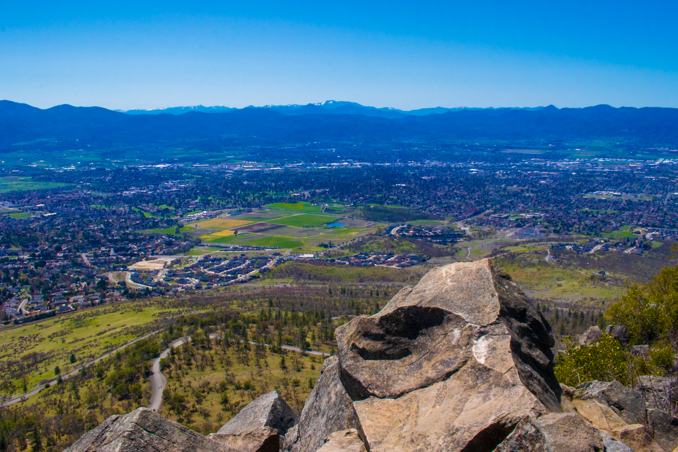
Less than a half-mile from the start, you’ll discover the Roxy Ann Picnic area, perfect for relaxing and enjoying a packed lunch in nature. As you continue your ascent, you will find beautiful views of the Upper and Lower Table Rocks. Continue for another half mile until you reach the trail on the right marked ‘TR’. This will begin your main assent to Roxy Ann Peak. Shortly after you make this turn, you’ll see a sign for the “North Roxy Overlook”. It’s a short detour, but not to be missed. On a clear day not only can you see the Table Rocks and Mount McLoughlin, but also Mount Thielsen! As you leave the “North Roxy Overlook”, continue up the ‘TR’ trail toward the top, catching breathtaking views of Mount McLoughlin along with wildflowers, madrone trees, and deer scurrying up and down the mountain.
The last half mile to the top is the toughest, with 500 of the 800 feet of elevation gain. The views at the top will reward you well, with one of the best main outlooks to the valley in southern Oregon. Be sure to look toward the south, where you can also catch views of Pilot Rock and California’s Mount Shasta.
Roxy Ann Peak and Prescott Park's trail system offers a diverse experience for all levels of expertise. Whether it’s a short hike, a picnic, trail running, horseback riding or mountain biking, you’ll find something for everyone on Roxy Ann Peak!
FAST FACTS
Roxy Ann Peak ( Prescott Park)
Difficulty: Easy to Moderate, your choice
Enchanted Forest: 3.5 miles round trip, varies based on route, 700 foot elevation gain
Restrooms: Port-a-potties at the trailhead
Optimal Season: Year around
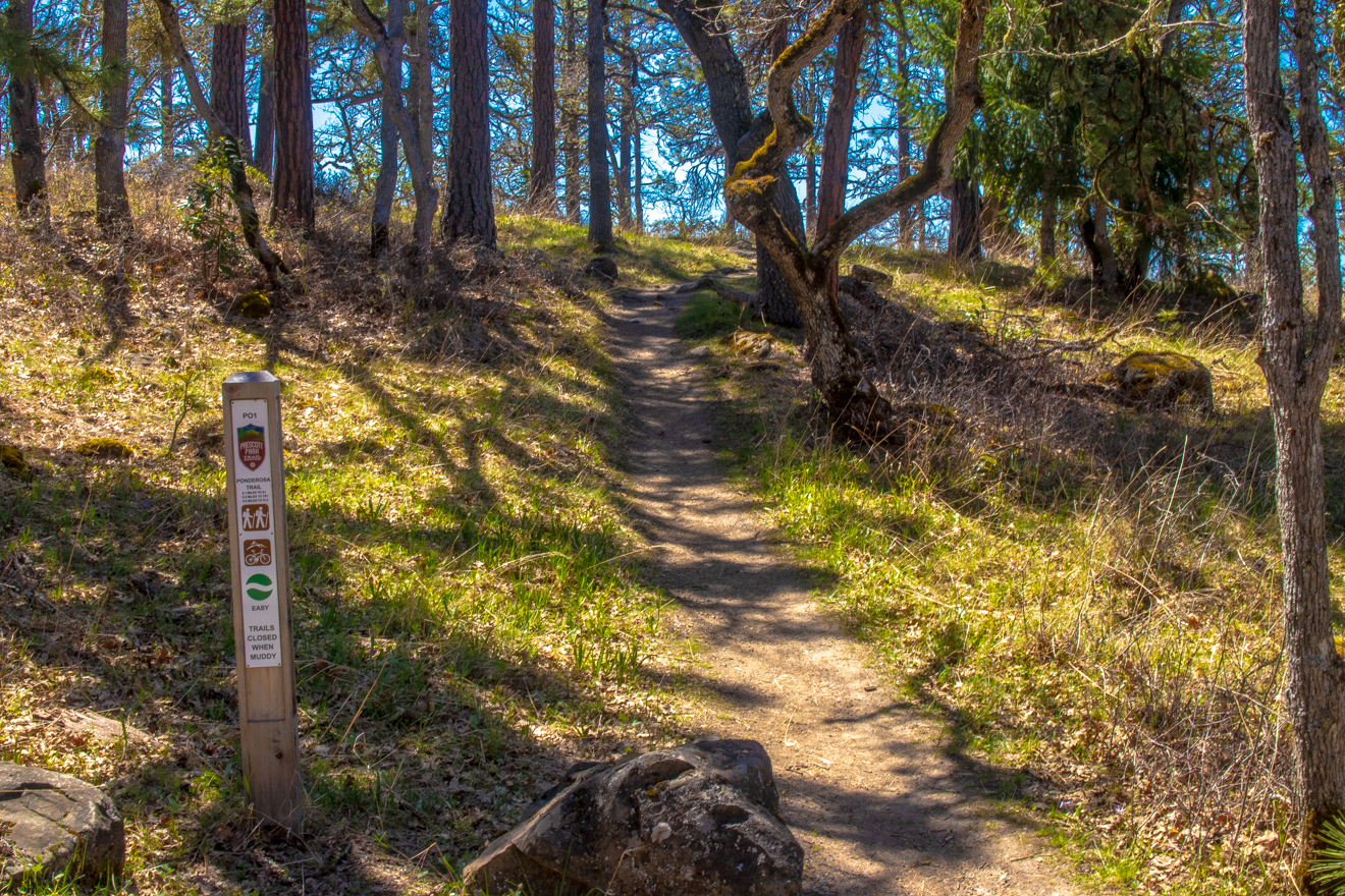
TRAIL FEATURES
This unique system of trails is perfect for family hikes, trail running, mountain biking, bird watching and dog walking! Soak in unbeatable views of the Heart of the Rogue, and relax at one of the lovely picnic areas throughout the trail. Equestrians are also welcome to the trails, with each trail distinctly marked for its capabilities. Be aware of poison oak and possible ticks throughout the warmer months, and slippery trails during the rainier seasons.
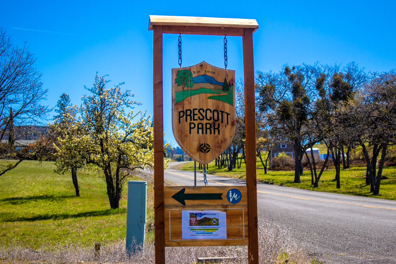
DIRECTIONS FROM MEDFORD
Take McAndrews Road east past Foothill Road for an additional 2.5 miles. Turn left at Roxy Ann Road (you will see the Prescott Park sign) and follow the road approximately 2.7 miles to the main parking area. The main trailhead is just east of the main parking area and is marked by signage.
Discover all you could want and more at this lovely system of trails! From mountain biking to picnic and photography opportunities, Roxy Ann Peak and Prescott Park have something for everyone.